
Visit us at our new location: 22 William Street in historic downtown New Bedford


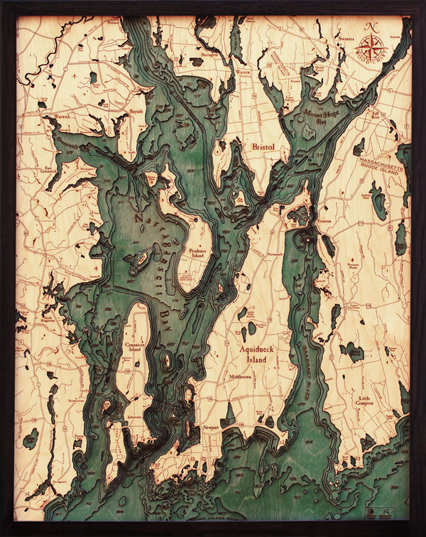


A 3-D nautical wood map featuring Narragansett Bay and Newport, Rhode Island that measures 24.5" wide by 31" high.
Narragansett Bay, on the north side of Rhode Island Sound, forms New England's largest estuary, which functions as an expansive natural harbor, and includes a small archipelago. Small parts of it extend into Massachusetts.
Points of Interest:
Aquidneck Island, Conanicut Island, Prudence Island, Providence River, Rhode Island Sound, Mount Hope Bay, and the Sakonnet River.
The laser cut map is made from Baltic birch and has a solid wood frame behind plexi-glass. The maps arrive ready to hang.
Love this product? Login to your customer account and add it to your wishlist!
It all starts with an idea, full of potential, and ready to be transformed. Let's discover what we can create together.
Sign up for our monthly newsletter, The Sketchbook.